 Boundary Survey Boundary Survey Drafting: Turning Field Data Into a Clear, Defensible Drawing
RLD · CAD Drafting Services
A boundary survey establishes where a property begins and ends. The fieldwork and the surveyor's analysis determine the boundary, but the drawing is what clients, attorneys, lenders and neighbors actually see. A clear, well-annotated boundary drawing makes the surveyor's findings easy to understand and hard to misread.
What Goes Into a Boundary Survey Drawing
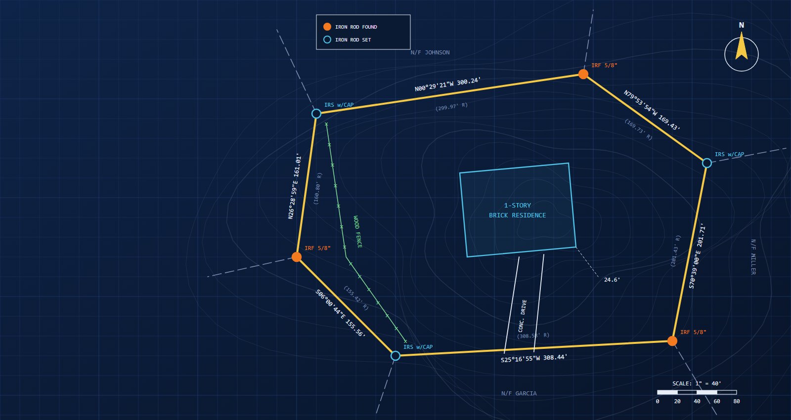
- Property lines with bearings and distances, and full curve data
- Record and measured values where they differ, clearly distinguished
- Monuments found and set, with type, size and condition
- Adjoining owners and their recording references
- Easements and rights-of-way from the title commitment or record documents
- Improvements near the lines, such as buildings, fences and driveways, with offsets
- Visible encroachments and gaps or overlaps with adjoining parcels
- Basis of bearings, legal description, surveyor's certification and notes
From Field Data to a Finished Drawing
- Import the points with description keys so monuments and features get the right symbols and layers.
- Draft the boundary from the surveyor's solution, and check that it closes within tolerance.
- Label lines and curves with record and measured values in a consistent format.
- Add improvements and offsets where they are close to the lines.
- Prepare the sheet with the legend, notes, legal description, vicinity map and title block.
Record vs. Measured: Keeping It Clear
Discrepancies between the deed and the field measurements are normal, but they must be shown without confusion. A common approach is to show the record value in parentheses next to the measured value, with a note explaining the convention. Whatever format your firm uses, apply it the same way on every line.
Quality Checks Before Delivery
| Check | Why it matters |
| Closure of the boundary | Confirms the drafted geometry matches the solution |
| Labels match the legal description | Prevents conflicts between the drawing and the deed text |
| Every monument is in the legend | Lets readers identify what was found and set |
| Encroachments are dimensioned | Gives title and legal teams the facts they need |
How RLD Helps
We draft boundary surveys in Civil 3D from your field data and boundary solution, using your templates and labeling conventions. Your surveyor stays in control of the analysis and certification, and we handle the drafting so your crew can stay in the field. Request a free trial to get started.
Need help with a drafting project?
Send a sample and try our Civil 3D drafting free.