Available for new projects

CIVIL 3D DRAFTING SUPPORT For Land Surveying & Engineering Firms

I'm Rutuja Murumkar, a CAD Technician and Land Survey Drafting Specialist. Backed by a team of skilled drafters, I give surveying firms across North America accurate, consistent drawings delivered on time.

Reliable
Accurate
Scalable Support
Rutuja Drafting Solution logo
✓
Accurate Drafting
24
24×7 Support
Boundary SurveyTopographic SurveyALTA/NSPS SurveySubdivision PlatsAs-Built SurveyConstruction & Site PlansLand DevelopmentLot Grading & Utility PlansSurvey Base Maps Boundary SurveyTopographic SurveyALTA/NSPS SurveySubdivision PlatsAs-Built SurveyConstruction & Site PlansLand DevelopmentLot Grading & Utility PlansSurvey Base Maps
Rutuja Murumkar, CAD Technician
"Your Drafting Partner"Free trial project available
About Me

Rutuja Murumkar

CAD Technician | Land Survey Drafting Specialist · India

I'm a CAD Technician who believes great drafting starts with great communication. I make a point of understanding client requirements clearly, running every job smoothly, and delivering drawings that make surveyors' work easier.

Backed by a professional team of skilled drafters, I support land surveying firms across North America with Boundary Surveys, Topographic Surveys, ALTA/NSPS Surveys, Subdivision Plats, and Construction & Site Plans.

Accuracy, clarity, and consistency are at the core of everything I deliver.

I take pride in building strong client relationships and making sure every project is handled with care, attention to detail, and on-time delivery. If you want drafting support that is reliable, easy to work with, and professionally managed, I've got you covered.

AutoCADCivil 3DProgeCADSurveyStarSuperStarSurvey DraftingLand DevelopmentSubdivisionSite Plans
Our Drafting Services

Survey Drafting, Done Right

From property lines to final as-builts, drawings that follow your standards and are ready to submit.

01

Boundary Survey

Defines the precise property lines and corners of a parcel, identifies encroachments, and confirms legal limits for transactions, permits, and site planning.

02

Topographic Survey

Maps the natural and built features of the land, including elevations, contours, trees, utilities, and structures, for engineering, architectural design, and grading studies.

03

ALTA/NSPS Survey

Required for commercial real estate and title insurance. Provides the highest level of detail (boundaries, easements, zoning data, improvements, and access points) following strict national standards.

04

Subdivision Plats

Divide large parcels into smaller lots for development, with road layouts, utility planning, easements, and the lot boundaries required for municipal approval.

05

As-Built Survey

Documents the exact location and details of completed construction elements such as buildings, utilities, and site grading, to verify compliance with approved plans and support final project documentation.

06

Construction & Site Plans

Construction-ready site plans and land development drawings in Civil 3D that bring together survey data, design intent, and your firm's CAD standards.

Key Insights

From Field Data to Accurate Drawings

Land Surveying + Civil 3D Drafting = Better Decisions, Smarter Development.

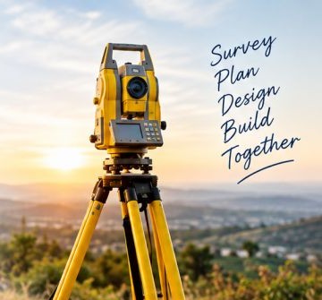
Total station on a tripod at sunrise: Survey, Plan, Design, Build Together

Accuracy Matters

Every point, line, and boundary tells a story. Accurate survey data leads to reliable, successful projects.

The Right Tools Make a Difference

Autodesk Civil 3D, ProgeCAD, SurveyStar, and SuperStar turn field data into detailed, professional drawings.

Great Results Are a Team Effort

Collaboration between surveyors, drafters, and engineers ensures quality, efficiency, and client satisfaction.

Keep Learning, Keep Growing

New technology, better workflows, and continued learning help us build a stronger foundation for the future.

Tools of the Trade

Software I Work With

A
AutoCAD
CC3D
Civil 3D
P
ProgeCAD
★
SurveyStar
S
SuperStar

Typical Project Types

  • Boundary Surveys
  • Land Development
  • Topographic Surveys
  • As-Built / Record Drawings
  • Existing Conditions
  • Survey Base Maps
  • Site Plans
  • Lot Grading & Utility Plans
  • Subdivision Plans
  • Construction Support
Better Data.
  Better Drawings.
    Better Projects.
Why Choose Me

Your Drafting Partner

Extra drafting capacity when you need it, without the overhead of hiring.

Dedicated Team

Skilled drafters focused on your projects.

Accurate Drafting

Precise, standards-compliant drawings.

On-Time Delivery

Deadlines met, every time.

24

24×7 Support

Work moves while your office sleeps.

Competitive Cost

Professional quality at a fair price.

How It Works

Simple, Smooth Workflow

Clear communication at every step, from the first file you send to the final drawing set.

01

Field Data

Send your field data, sketches, and CAD standards.

02

Survey Processing

Points, descriptions, and linework are reviewed and set up, and scope and timeline are confirmed.

03

Civil 3D Drafting

Accurate drafting with internal quality checks.

04

Accurate Deliverables

On-time delivery, with quick revisions as needed.

Land Surveying isn't just about measurements, it's about creating a clearer picture of what's possible.

Keep Surveying,
Keep Building

Free Trial Project Available

Let's start building your success today. Need extra drafting capacity? Send a sample project and see the quality for yourself.

Let's Connect →
Contact

Let's Work Together

Tell me about your project and I'll get back to you promptly.

Get in Touch

Professional & expert CAD technicians, ready to support your next survey project.

LocationIndia · Serving firms across North America
Availability24×7 Drafting Support

Request a Free Trial

Opens your email app with the details filled in.

↑